Depth Completion: A Bridge to Connect 2D with 3D
Abstract
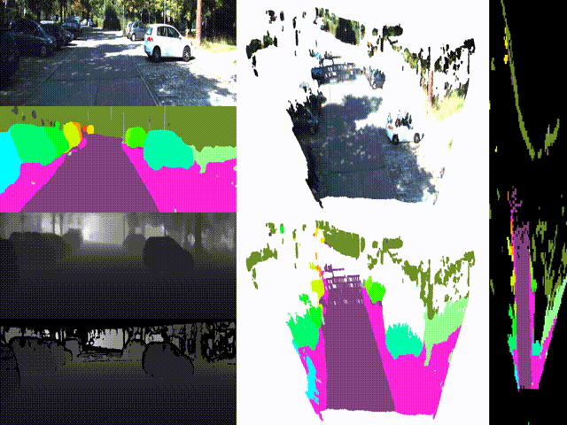
LiDAR depth completion is a task that predicts depth values for every pixel on the corresponding camera frame although only sparse LiDAR points are available. With the completed depth map, all 2D computer vision models on the 2D image are able to be embedded into the 3D world. This is a demo that maps panoptic segmentation of the 2D image to the 3D surroundings.